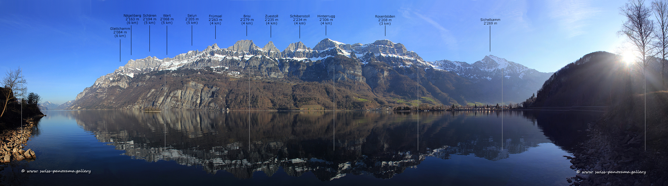
Beschriftetes 180 Grad Panorama vom Walensee.
Der Walensee verbindet die beiden Kantone St. Gallen und Glarus. Er liegt auf 419m über Meer und hat eine Oberfläche von 24 km². Seine grösste Tiefe beträgt 151 m. Imposant und steil erheben sich die Churfirsten auf der Nordseite des Walensee. Sie bilden zusammen mit der Alvier Gruppe und dem Alpstein Massif die Appenzeller Alpen.
The Walensee connects the two cantons of St. Gallen and Glarus. It lies at 419 m above sea level and has a surface area of 24 km². Its greatest depth is 151 m. The Churfirsten mountains rise imposingly and steeply on the north side of the Walensee. Together with the Alvier Group and the Alpstein Massif, they form the Appenzell Alps.
Walensee - Beschriftetes Alpenpanorama nach Wintereinbruch in den Bergen.
Unterhalb des Frümsel zu sehen ist das Bergwerk Lochezen.
Klicken Sie auf das Bild, um es im Panorama Viewer zu betrachten
Click on the image to enlarge it to full-screen display in panorama viewer.
Auf Ihrem Desktop können Sie das Bild in grösserem Format im Viewer für Panorama Bilder betrachten.
You can view the image in a larger format on your desktop in the viewer for panorama images.
Detail des obrigen Panorama Bild.
Das ehemaligen Bergwerk Lochezen.
Detail des obrigen Panorama Bild.
Das ehemalige Bergwerk Lochezen befindet sich unterhalb des Frümsel auf dem Gebiet der Gemeinde Walenstadt. Dessen Geschichte geht bis in die frühindustrielle Zeit im 1861 zurück.
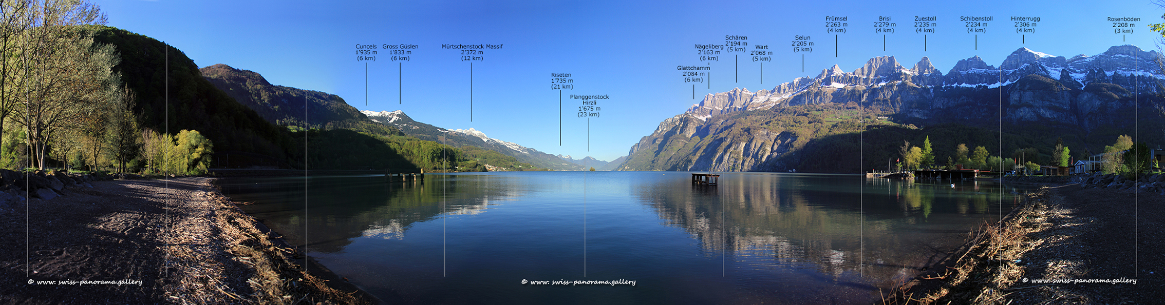
Beschriftetes Alpenpanorama von Walenstadt.
Klicken Sie auf das Bild, um es im Panorama Viewer zu betrachten
Click on the image to enlarge it to full-screen display in panorama viewer.
Auf Ihrem Desktop können Sie das Bild in grösserem Format im Viewer für Panorama Bilder betrachten.
You can view the image in a larger format on your desktop in the viewer for panorama images.
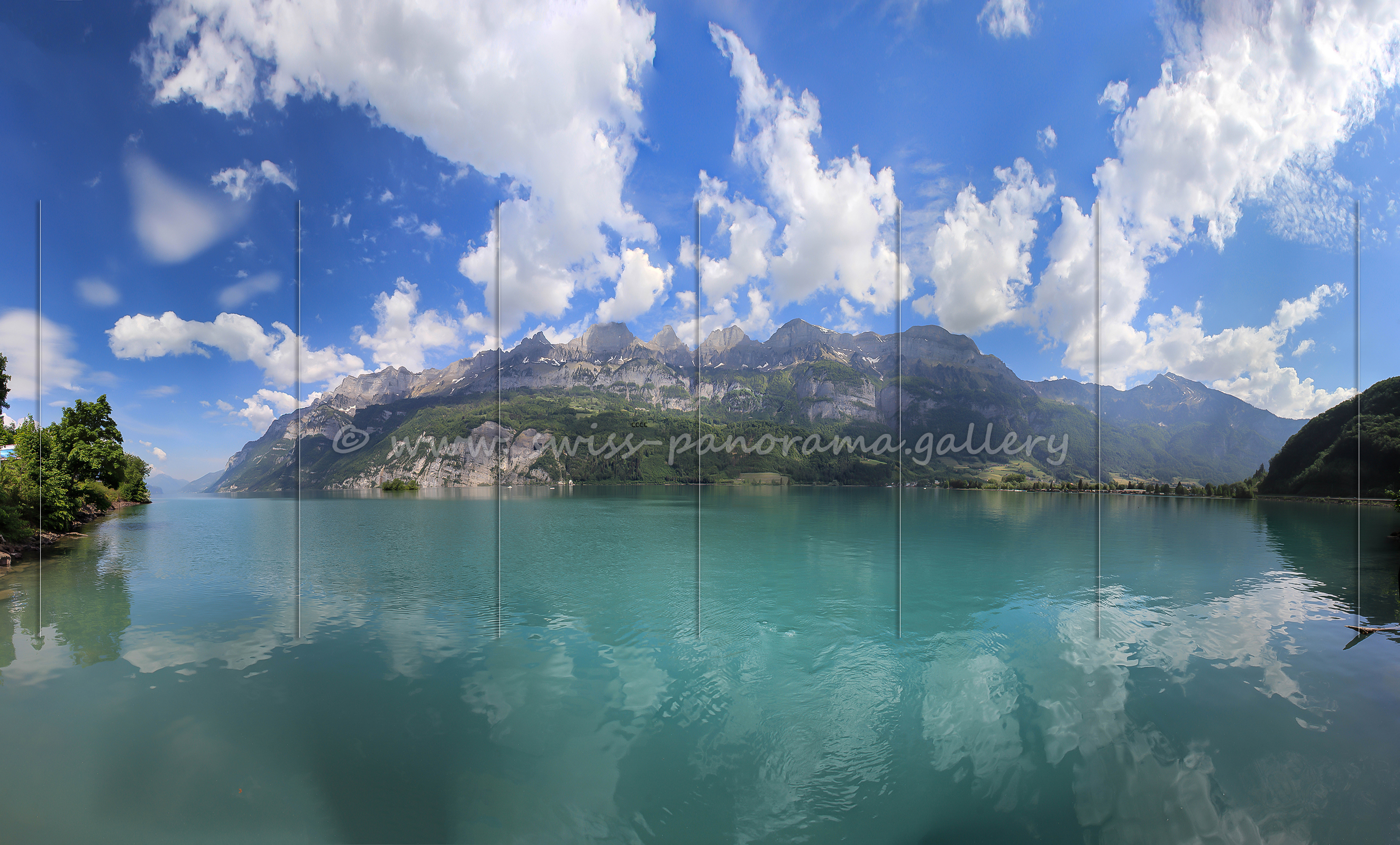
Beschriftetes Alpenpanorama von Gäsi.
Klicken Sie auf das Bild, um es im Panorama Viewer zu betrachten
Click on the image to enlarge it to full-screen display in panorama viewer.
Auf Ihrem Desktop können Sie das Bild in grösserem Format im Viewer für Panorama Bilder betrachten.
You can view the image in a larger format on your desktop in the viewer for panorama images.
Auf die Bild zu sehen ist der Musle Wasserfall und die Serenbach Wasserfälle. Die Seerenbachfälle bei Betlis bilden eine Kaskade von drei Wasserfällen entlang des Seerenbachs mit einer Gesamthöhe von 585 Metern. Die Serenbachfälle sind am eindrücklichsten bei der Schneeschmelze im Frühling oder nach starken Regenfällen. Oftmals sind die Wasserfälle aber nur als Rinnsal zu erkennen.