Scroll To Top
Linth Ebene
 
 
Linthebene - Beschriftetes Panorama zu Rautispitz und Glärnisch.


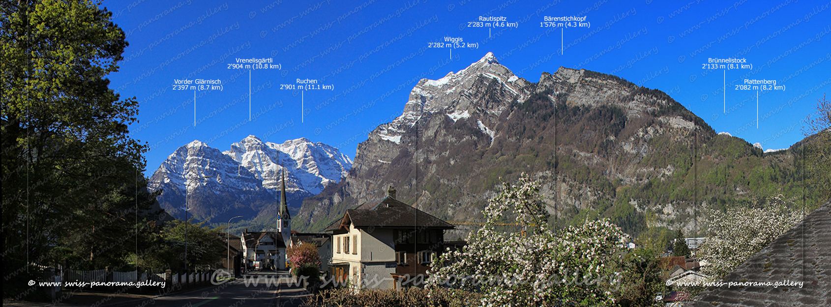
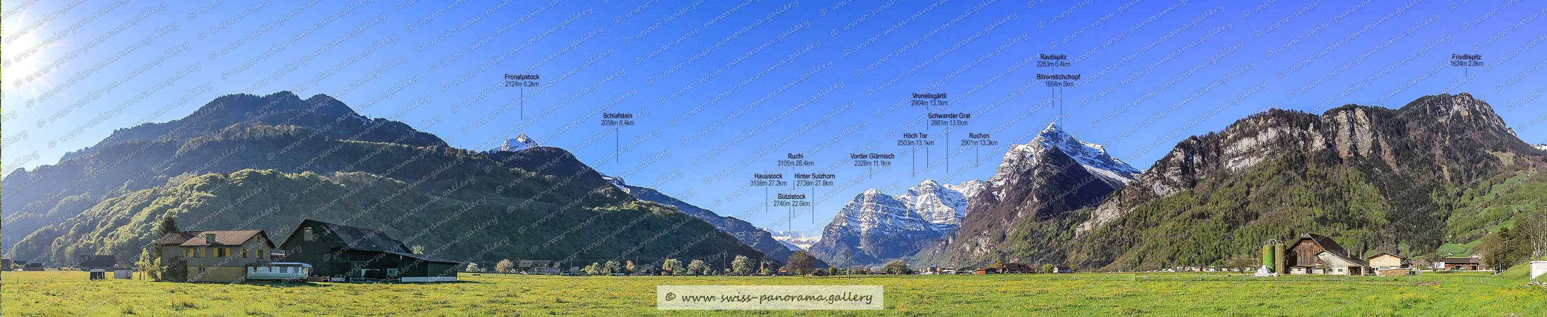
Die Linthebene ist eine geographische Region zwischen dem Zürichsee und dem Walensee. Der obere Teil der linksseitigen Linthebene mit den Dörfern Bilten, Niederurnen, Oberurnen, Näfels und Mollis gehört zum Kanton Glarus. Das obige Bild zeigt den vertrauten Blick von nahe Niederurnen von entlang der Nationalstrasse N3 kurz vor dem Walensee Tunnel. Hier erhebt sich das Glärnisch Massiv um etwa 2500 Meter vom Talgrund.

The Linth Plain is a geographical region between Lake Zurich and Lake Walen. The upper part of the left-hand side of the Linth Plain with the villages of Bilten, Niederurnen, Oberurnen, Näfels and Mollis belongs to the canton of Glarus. The picture above shows the familiar view near Niederurnen from along the N3 national road just before the Walensee Tunnel. Here the Glärnisch Massif rises about 2500 meters from the valley floor.


Panorama Linthebene, Mollis,  Beschriftetes Schweizer Alpenpanorama Linthebene , Panoramic picture of the Swiss Alps, Panoramic photos of the Swiss Alps, Beschriftetes Panorama Walensee, Beschriftetes Panorama Glarner Alpen, Höch Tor 2503m, Vorder Glärnisch 2328m, Ruchen 2901m GL (Glärnisch), Vrenelisgärtli 2904m, Auerenhorn 1539m 5,1km (Rautispitz), Wiggis 2282m GL   (Rautispitz), Hochnasen 2195m GL  (Rautispitz), Trosegg GL 1734m (Rautispitz), Brünnelistock 2133m, Wisswand 1665m GL (Nähe Rautispitz), Schwander Grat 2881m  , Plattenberg 2062m  GL/SZ (Wägital), Bärenstichchopf 1664m GL (nähe Rautispitz)   , Rautispitz 2283m GL, , swiss-panorama.gallery, famous Swiss Alps, Swiss Panorama Gallery, labelled mountain panorama from Switzerland,
Mollis
Bergblick von Mollis zum Glärnisch und Rautspitz.