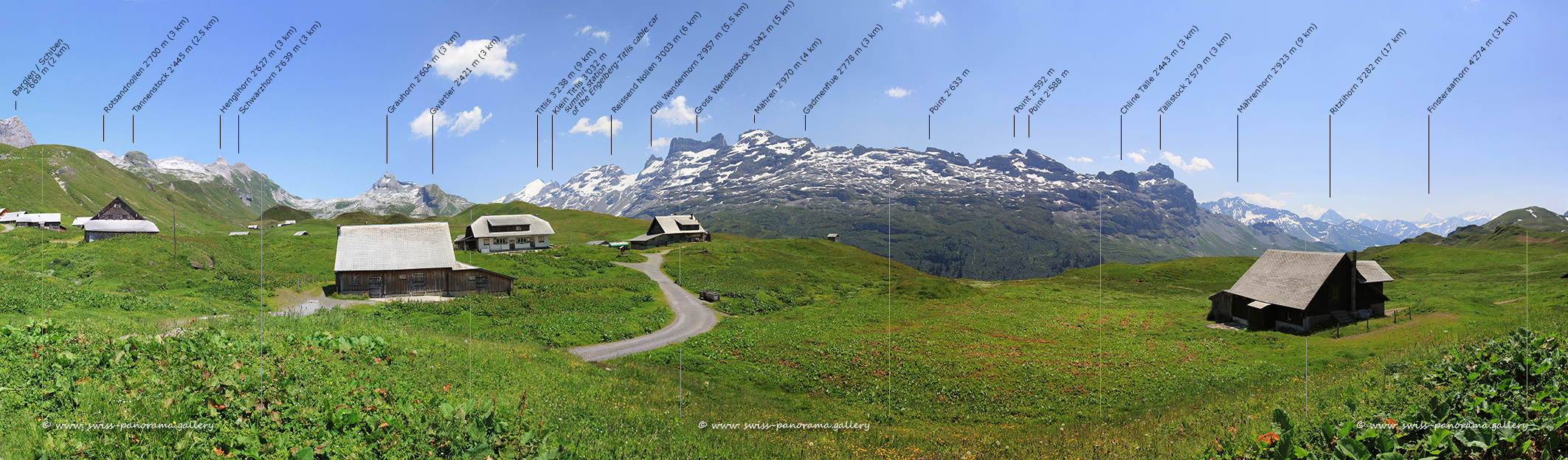
Tannalp auf der Melchsee Frutt.
Klicken Sie auf das Bild, um es im Panorama Viewer zu betrachten
Click on the image to enlarge it to full-screen display in panorama viewer.
Auf Ihrem Desktop können Sie das Bild in grösserem Format im Viewer für Panorama Bilder betrachten.
You can view the image in a larger format on your desktop in the viewer for panorama images.
Der Hochtal- und Bergferienort Melchsee-Frutt liegt auf einer Höhe von rund 2000 Metern im Kanton Obwalden. Melchsee-Frutt ist ein verkehrsfreies Wander- und Skigebiet mit beschränkten Zufahrtszeiten für Autos. Im Sommer kann der Taleingang mit dem Auto erreicht werden, allerdings nur zu bestimmten Zeiten. Das Gebiet ist aber ganzjährig durch eine Seilbahn von der Stöckalp aus erreichbar.
The high valley and mountain holiday resort of Melchsee-Frutt lies at an altitude of around 2000 metres in the canton of Obwalden. Melchsee-Frutt is a traffic-free hiking and skiing area with limited access for cars. In summer, the valley entrance can be reached by car, but only at certain times. However, the area is accessible all year round by cable car from the Stöckalp.
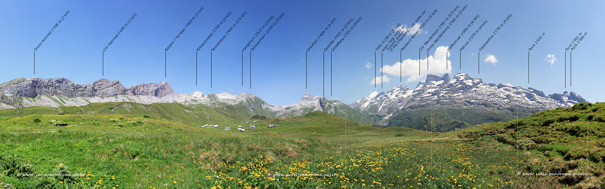
Tannalp auf der Melchsee Frutt.
Klicken Sie auf das Bild, um es im Panorama Viewer zu betrachten
Click on the image to enlarge it to full-screen display in panorama viewer.
Auf Ihrem Desktop können Sie das Bild in grösserem Format im Viewer für Panorama Bilder betrachten.
You can view the image in a larger format on your desktop in the viewer for panorama images.