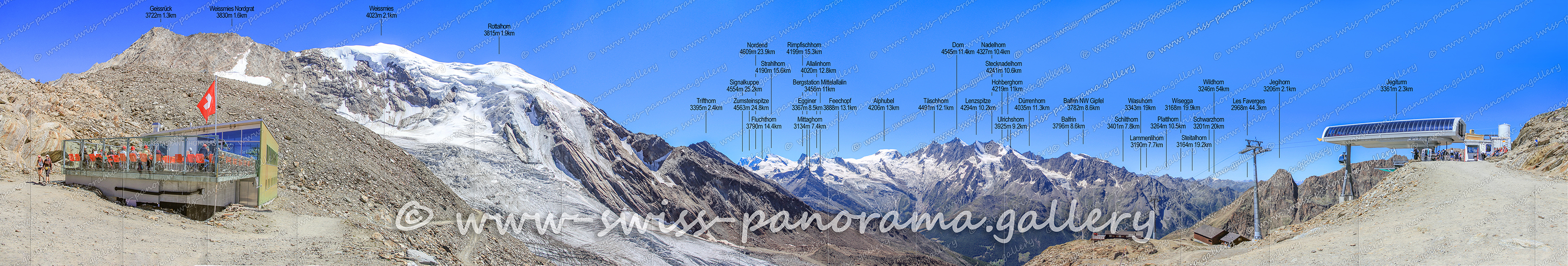
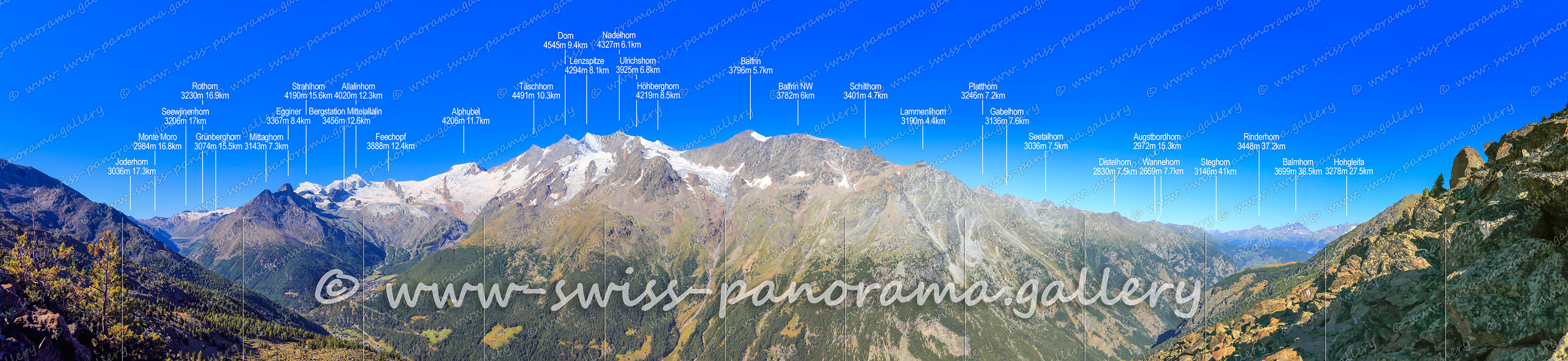
340 degree Panorama from Hohsaas at 3140 m.
Click on the image to enlarge it to full-screen display in panorama viewer.
The Saas Valley is the eastern branch of the Visp Valley, where it joins the Matter Valley to the west at the village of Stalden. The two valleys are separated by the Mischabel group. This comprises no less than 13 four-thousand-metre peaks (Täschhorn 4491 m, Dom, 4545 m, Lenzspitze 4294 m, Nadelhorn 4328 m, Stecknadelhorn 4241 m, Hohberghorn 4219 m, Dürrenhorn 4034 m, Alphubel 4206 m, Allalinhorn 4027 m, Rimpfischhorn, 4198 m, and Strahlhorn, 4190 m). From Hohsass at 3140 metres, situated at the foot of the Weissmies, 18 peaks over 4000 metres can be seen.
Click on the image to enlarge it to full-screen display in panorama viewer.
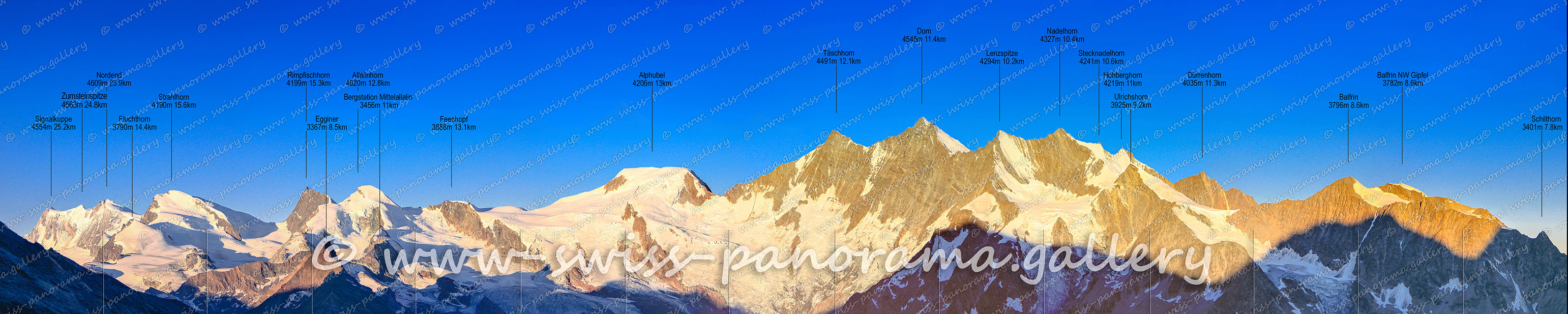
Panorama Sunrise on Hohsaas.
Click on the image to enlarge it to full-screen display in panorama viewer.
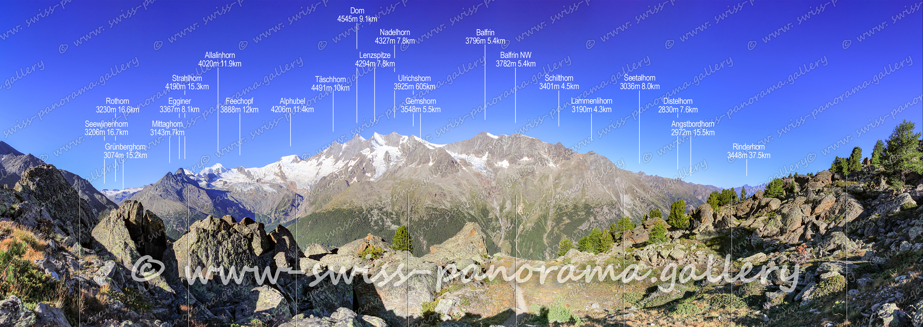
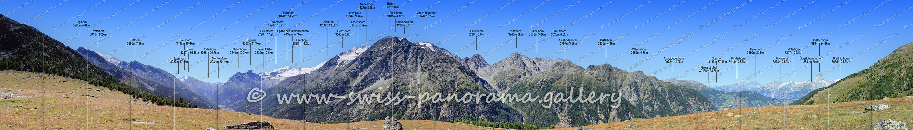
Panorama from along the hiking trail from Kreuzboden to Gspon.
Click on the image to enlarge it to full-screen display in panorama viewer.
The high-level trail from Kreuzboden (below Hohsaas) leads above the tree line from Gspon to Kreuzboden. The Gspon high trail offers a wonderful view of the 4,000-metre peaks of the Mischabel chain. Walking the entire trail is only recommended for good mountain walkers. Surefootedness is a prerequisite in some places along the trail.
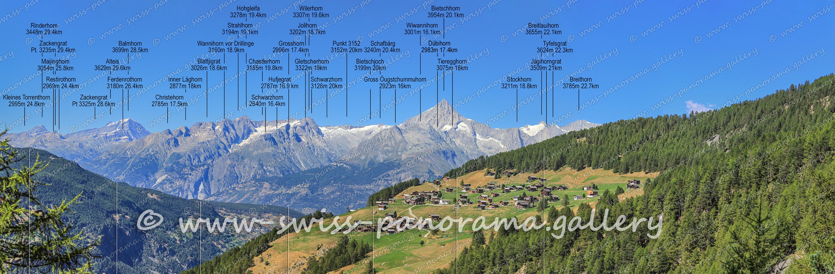
Panorama from along the hiking trail from Kreuzboden to Gspon.
Click on the image to enlarge it to full-screen display in panorama viewer.
Panorama from along the hiking trail from Kreuzboden to Gspon.
Click on the image to enlarge it to full-screen display in panorama viewer.
Click on the image to enlarge it to full-screen display in panorama viewer.
Gspon at 1900 metres above sea level is a hamlet in the municipality of Staldenried and lies on a sunny terrace high above the Saas Valley. The hamlet can be reached by a small aerial cableway from the Stalden station of the Matterhorn-Gotthard railway.